Where we are
Introduction
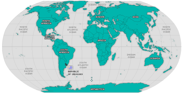
This is a big meadow bordered by the waters of the plentiful river from which it takes its name, by the Río de la Plata and by the sea whose beautiful beaches are a real gift. The Oriental Republic of Uruguay lies on the East coast of the Atlantic Ocean, in the Southern hemisphere temperate zone. It stands between 30º and 35°S and 53° and 58°W. It has a territorial surface of 176,215 square kilometers, relatively smaller than other countries in South America but larger in size than various countries in Central America and Europe. Likewise, it features 120,684 square kilometers of territorial sea plus the jurisdictional waters of rivers and lagoons.

It borders on the Republic of Brazil to the North, on the Republic of Argentina to the West through the Uruguay River, on the Río de la Plata to the South and on the Ocean to the East.
Its strategic geopolitical location encourages integration, as this is the gate to the Plata basin and a bridge between the country and its big neighbors, Argentina and Brazil. Furthermore, it has an easy communication way with the rest of the world.
On the other hand, the 450 kilometers of coastline along the Río de la Plata and the 220 kilometers of sea coast on the Atlantic provide Uruguay with a vast chain of sandy beaches whose beauty attracts a large number of foreign tourists.
It is politically divided into 19 departments: Artigas, Canelones, Cerro Largo, Durazno, Colonia, Flores, Florida, Lavalleja, Maldonado, Montevideo, Paysandú, Río Negro, Rivera, Rocha, Salto, San José, Soriano, Tacuarembó and Treinta y Tres. With 3,323,906 inhabitants (a projection based on the 1996 National Census), Uruguay has an essentially urban population, though its economical profile is outlined by cattle activities.
Here is an invitation to see and tour around this territory which, along with its people, its sceneries, its history and its present, is awaiting you at welcomeuruguay.com
© 2007-2026 Total or partial reproduction forbidden. Derechos de Autor 675244 Ley 11723
Who we are | Contact us | Terms and Conditions


